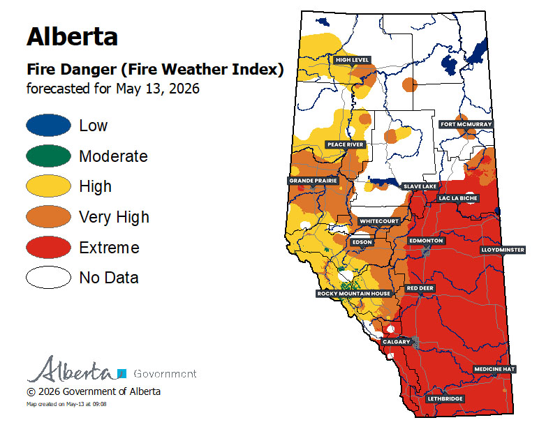
Fire Danger – Wednesday, May 13th
The High to Extreme fire danger continues to persist across much of Alberta today thanks to the warm, dry conditions and strong wind gusts developing this afternoon. However, this is expected to change drastically over the next couple of days, with the arrival of a strong low later today that will bring very strong winds and significant rain to Central and Southern Alberta tomorrow and snow to Northern Alberta on Friday and Saturday.
We could see some scattered showers develop later today, along with the possibility of a weak thunderstorm or two, as the low makes its way through the province. Overnight and into early tomorrow morning, on the backside of the strengthening low, the strong winds and heavy rain will start to impact the province. Since the majority of the rain will arrive tonight, the impacts on the fire danger will be reflected on tomorrow’s map.
Reminder:
Extreme fire danger indicates that forest fuels are extremely dry. Any fires that start would be fast-spreading and high-intensity fires, which are very difficult to control.
With this in mind, fire restrictions and bans have already been put in place across parts of the province. Please heed any of these restrictions in your area and stay safe!
– Alannah


