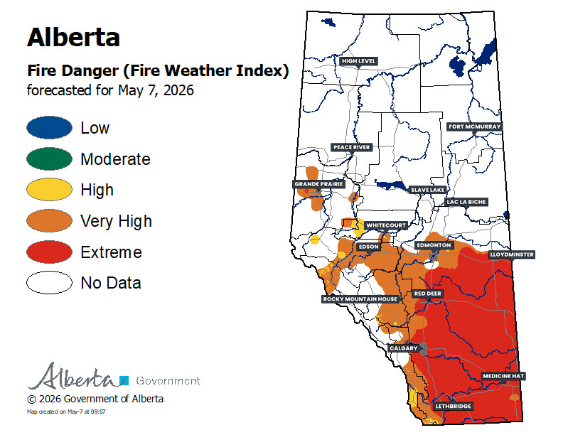
Fire Danger – Thursday, May 7th
Today will pretty much be a repeat of yesterday. It will be another warm day with scattered showers developing in the afternoon, along with the chance for isolated thunderstorms. Any thunderstorms that end up forming are expected to be non-severe and the greatest threat will be strong wind gusts.
This continued patterns means that there is little change to the Fire Danger map for today, with the majority of Central and Southern Alberta remaining at Very High or Extreme risk.
Reminder:
Extreme fire danger indicates that forest fuels are extremely dry. Any fires that start would be fast-spreading and high-intensity fires, which are very difficult to control.
This time of year is particularly dangerous for forest fires, with dead vegetation leftover from last year and moisture content in conifer needles being it at its lowest before this year’s foliage flushes. This is known as spring dip.
With this in mind, fire restrictions and bans have already been put in place across parts of the province. Please heed any of these restrictions in your area and stay safe!
– Alannah


