Fire Danger – Friday, May 15th
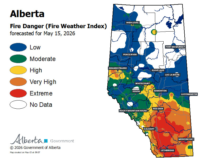
The fire danger across much of the province is continuing to decrease, including some change in the highest risk areas of Central and Southern Alberta, as cool conditions persist and yesterday’s intense winds have died down.
A mixture of rain and snow will continue across parts of Northern and East Central Alberta today, which will help to keep the risk lowered in that area. Further south, there will be the chance of showers, and maybe an isolated thunderstorm, in Southern Alberta this afternoon and evening. Moving into the overnight hours, we’ll see snow start to fall in the Mountains and Foothills, which will continue through Saturday.
We’re still expecting to see the area of High to Extreme fire risk to shrink over the coming days with continued cool and humid conditions.
There are still fire restrictions and bans in place across much of the province. Please heed any of these restrictions in your area and stay safe!
– Alannah


